Custom Star Map Poster
A poster-ready layout from the start: the sky disc fills the upper three-quarters, your caption sits beneath, and the canvas matches standard frame sizes.
Design your poster
Free, in your browser — no account, nothing uploaded. Both downloads are the complete chart: a vector SVG and a 300 dpi PNG, with nothing held back and nothing to buy.
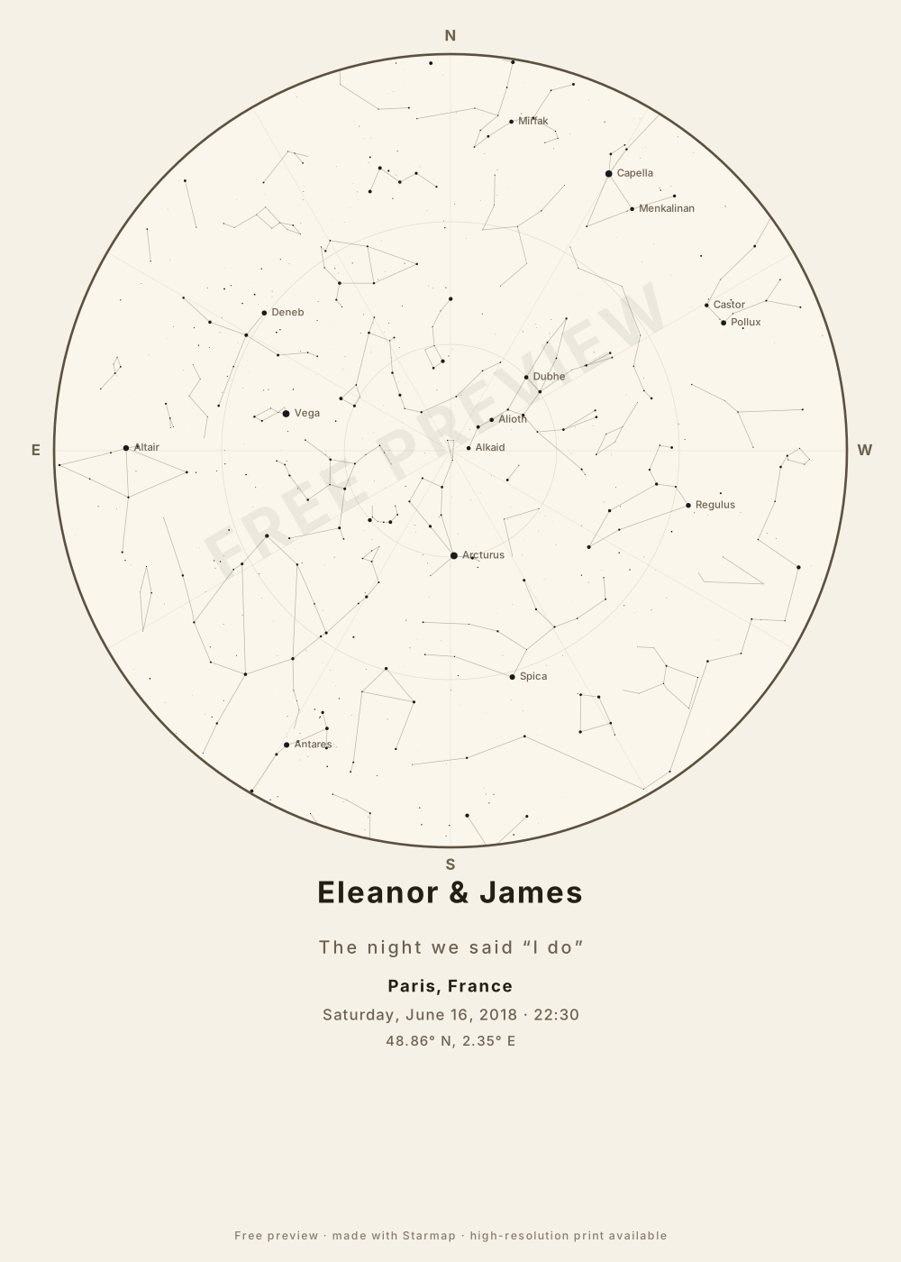
Sizes and themes
- 30×40 cm and 50×70 cm — the two most common European frame sizes off the shelf.
- 18×24 in — the US standard.
- Night theme — white stars on deep navy; striking, ink-heavy to print.
- Ink theme — dark stars on warm paper white; looks like an engraving and is the economical print.
What resolution does a poster need?
Print shops want ~300 dpi. At 50×70 cm that is roughly 5,900 × 8,300 pixels — and that is exactly what the PNG download is: your chosen page size rasterized at 300 dpi, so 50×70 cm lands at 5906 × 8268 px and 24×36 in at 7200 × 10800 px. The SVG has no resolution at all to run out of — it is vector, so a shop that accepts SVG can scale it to a billboard. Both are free and complete; the only mark is one credit line along the bottom edge.
Two honest limits. There is no PDF export — if your shop insists on PDF, drop the PNG into any image-to-PDF step. And the PNG is built in your browser's memory: a 5906 × 8268 canvas is nearly 49 megapixels, which desktops handle fine but some phones (iOS Safari in particular caps canvas area) will refuse. If the PNG fails on a phone, take the SVG, or make the same map again on a laptop.
How the map is computed
You give it three things: a date, a time, and a place. For the place, type a town or city name and pick it from the list — 29,919 towns and cities of 18,000 people or more, from GeoNames — or enter an exact latitude and longitude instead. Accents are optional (“malmo” finds Malmö), but type the name on its own: “Roskilde Denmark” finds nothing, and a typo finds nothing rather than the wrong sky.
Your date, time and place are converted to a Julian Date and then to local sidereal time — the astronomer’s clock for “which way is the sky facing.” Each of the 1,630 stars in the Yale Bright Star Catalogue (every star brighter than magnitude 5.0, i.e. every star a good naked eye can see) is transformed to its altitude and azimuth at that exact moment, and every one of those stars above the horizon is projected onto the circular chart: zenith at the centre, horizon at the rim, north at the top — and east on the left, because a star map is read looking up, which mirrors east and west compared to a ground map.
The 89 constellation figures are drawn with the same math and clipped at the horizon. Star dots are scaled by real brightness (magnitude) and tinted by star colour. The Moon is drawn at its real altitude, azimuth and phase for your moment, and left off entirely when it was below your horizon. It does not show the planets, comets or satellites — those wander against the fixed stars and need ephemerides, which this version does not compute. Everything runs in your browser — nothing is uploaded, there is no account, and the page works offline once loaded.
Common questions
What file should I take to the print shop?
The PNG: 300 dpi at your chosen size, e.g. 5906 × 8268 px for 50×70 cm. If the shop accepts SVG, send that instead — vector art has no fixed resolution, so it is sharper at any size. Both are free; there is no separate print file to buy.
Which theme is cheaper to print?
Ink-on-paper, by a wide margin: it's mostly unprinted paper. The navy night theme lays down ink across the whole sheet and looks best on heavier stock.
Can I make a landscape or square poster?
Not in v1 — the three presets are portrait, which is how star map posters are conventionally framed. More formats are on the backlog.